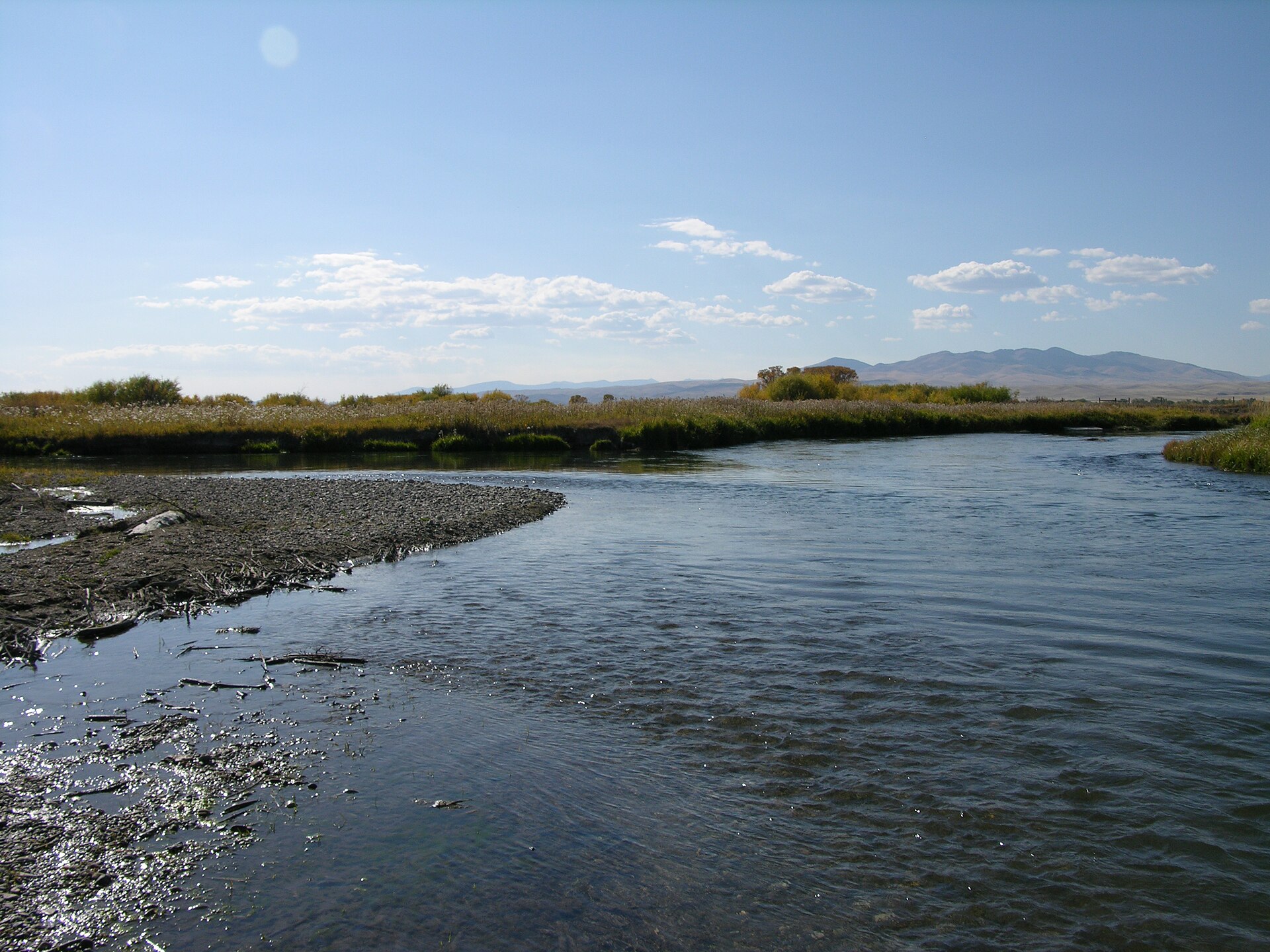
Dillon is arguably the best-positioned fishing basecamp in Montana. The Beaverhead River—a blue-ribbon trout stream—flows directly through town, and three more legendary rivers sit within an hour’s drive: the Big Hole, the Madison, and the Jefferson. That’s four world-class trout rivers accessible from a single small town of 4,000 people. Add 14 FWP fishing access sites, Clark Canyon Reservoir 20 miles south, Poindexter Slough’s technical spring-creek fishing 3 miles out, and two dozen alpine lakes in the Pioneer Mountains, and the scope of the fishery becomes extraordinary. Dillon’s fly shops and guide services have built their reputations on this concentration of quality water—there is simply no bad direction to drive from town if you’re carrying a rod. For Montana's fly fishing heritage and river guides, see our Fly Fishing Guide and Rivers Deep Dive. For the full city profile, see our Dillon guide.
At a Glance
- 8 lakes within 30 miles
- 14 FWP fishing access sites within 20 miles
- 4 major rivers within day-trip range
- Primary species: Brown trout, rainbow trout, westslope cutthroat, Arctic grayling, mountain whitefish
- Signature fishery: Beaverhead River—flows through town, trophy browns and rainbows to 22 inches
- Spring creek: Poindexter Slough (3 mi)—technical fishing for large, educated trout
- Unique species: Native fluvial Arctic grayling in the upper Big Hole River
- Reservoir: Clark Canyon Reservoir (20 mi)—feeds the Beaverhead, excellent stillwater fishing
- License required: Montana fishing license (available at local shops and fwp.mt.gov)
The Beaverhead River
The Beaverhead River is the centerpiece of Dillon’s fishing identity and the reason many anglers make the drive to southwestern Montana. Fed by the cold, consistent releases from Clark Canyon Dam 20 miles south, the Beaverhead maintains ideal water temperatures and flows through the summer months when other Montana rivers run warm and low. This tailwater character produces trophy-sized trout—brown trout and rainbow trout commonly measuring 18 to 22 inches, with fish exceeding 24 inches taken every season. The Beaverhead is not a numbers river; it is a quality river where every fish earned feels significant.
Species & Character
Brown trout are the Beaverhead’s headline species—heavy-bodied fish that hold in undercut banks, logjams, and the deeper runs that characterize much of the river between Clark Canyon Dam and the confluence with the Ruby River at Twin Bridges. Rainbow trout share the river in strong numbers, often in the faster riffles and runs. Mountain whitefish round out the cold-water community. The river’s substrate is cobble and gravel, with dense aquatic vegetation in many sections that harbors enormous populations of scuds, sowbugs, mayfly nymphs, and caddis larvae—the forage base that grows these large trout.
Techniques
The Beaverhead demands technical fishing. The river is not wide—often 40 to 60 feet across—and trout that see steady angling pressure throughout the season require precise presentations. Nymphing with small patterns (size 16–20 scuds, sowbugs, and PMD nymphs) under an indicator is the most consistent technique, but the reward comes when hatches bring fish to the surface. Pale morning duns (July–August), caddis (June–September), and blue-winged olives (spring and fall) produce dry-fly opportunities that test an angler’s casting accuracy. Streamer fishing with sculpin and leech patterns works well for targeting the largest browns, especially during fall and in low-light conditions.
Access & Float Sections
The most popular float section runs from Pipe Organ FAS (13 miles south) or Henneberry FAS (14 miles south) downstream to access points near town. This middle section of the Beaverhead offers the highest concentration of large trout and the most consistent flows. The upper river immediately below Clark Canyon Dam holds excellent fish but is narrower and more technical to float. Wade fishing is productive throughout, particularly at the named FAS sites where bank access is maintained. Poindexter Slough FAS (3 miles), Highway 91 Bridge FAS (3 miles), and Corrals FAS (9 miles) provide the closest access to Dillon.
Poindexter Slough
Three miles from downtown Dillon, Poindexter Slough is a spring creek that branches from and parallels the Beaverhead River before rejoining it downstream. This small, clear stream holds disproportionately large and notoriously selective trout in a spring-creek environment that humbles experienced anglers. The water is gin-clear and shallow—trout are visible but so is your leader, your shadow, and every imperfect drift. Weed beds line the bottom, providing cover and forage that grow fat fish in a narrow channel.
Poindexter Slough is strictly a technical fishing experience. Long leaders (12 feet minimum, often 15), fine tippets (5X to 7X), and precise dry-fly and emerger presentations are standard. The slough produces excellent hatches of PMDs, tricos, and blue-winged olives. Fish commonly run 16 to 20 inches despite the stream’s modest size. Special regulations apply—check current Montana FWP rules before fishing. For anglers who appreciate spring-creek challenge, Poindexter is one of the finest in the northern Rockies and alone justifies a trip to Dillon.
Big Hole River
The Big Hole River, 44 miles northwest of Dillon, holds a distinction shared by no other river in the lower 48 states: it sustains a native population of fluvial Arctic grayling—a species that once ranged across the upper Missouri basin but now survives only in the Big Hole’s upper reaches. These beautiful, sail-finned fish are a living remnant of Montana’s Ice Age aquatic heritage. Catching a native grayling on a dry fly in the upper Big Hole is one of the most meaningful angling experiences available in Montana—and it’s available from Dillon as a day trip.
Beyond grayling, the Big Hole is a superb trout river in its own right. Brown trout and rainbow trout populate the middle and lower reaches in excellent numbers, with brook trout in the upper river and tributaries. The Big Hole is famous for its salmonfly hatch—enormous stoneflies (Pteronarcys californica) that emerge in June and draw the river’s largest trout to the surface in a feeding frenzy that ranks among the premier hatch events in American fly fishing. The river’s character ranges from intimate meadow water in the upper valley to powerful canyon runs in the lower stretches. Special grayling regulations restrict fishing methods and seasons on certain sections—check Montana FWP for current closures and gear restrictions.
Madison River
The Madison River at Ennis, 45 miles northeast of Dillon, is one of the most famous trout rivers in the world. Born at the confluence of the Firehole and Gibbon rivers in Yellowstone National Park, the Madison flows north through the Madison Valley—a broad corridor between the Madison Range and the Tobacco Root Mountains—past Ennis and into Ennis Lake before plunging through Bear Trap Canyon to the Missouri headwaters. The 50-mile stretch between Quake Lake and Ennis Lake is the legendary water: a continuous riffle of pocket water, runs, and pools holding enormous populations of brown trout and rainbow trout.
The Madison’s reputation rests on its consistency and sheer biomass. This is not a river where you might get skunked—the trout density supports steady action on nymphs, dry-dropper rigs, and streamers throughout the season. The salmonfly hatch (late June) and caddis emergences (July–August) produce surface activity that borders on the surreal. Fall brings blue-winged olive hatches and streamer fishing for pre-spawn browns. The drive from Dillon to Ennis crosses the scenic Ruby Valley—less than an hour on good roads—making the Madison a practical day trip that expands Dillon’s already remarkable fishing portfolio.
Jefferson River
The Jefferson River, 51 miles north of Dillon, is formed by the confluence of the Beaverhead and Big Hole rivers at Twin Bridges and flows northeast to the Missouri headwaters at Three Forks. The Jefferson is the overlooked gem among Dillon’s accessible rivers—a broad, cottonwood-lined waterway that receives a fraction of the fishing pressure directed at the Beaverhead and Madison. Float fishing by drift boat or raft is the most productive approach, covering miles of water and accessing bank structure where large brown trout hold.
The Jefferson’s brown trout fishery improves in the fall, when fish move upstream from the Missouri headwaters to spawn. Hopper-dropper fishing in late summer and streamer fishing through October are particularly effective. The river’s low profile among visiting anglers is an advantage—solitude on the Jefferson is easier to find than on any of Dillon’s other rivers, and the fish are less pressured and often more willing.
Clark Canyon Reservoir
Clark Canyon Reservoir sits 20 miles south of Dillon at the head of the Beaverhead River, impounding the waters of the Red Rock River and Horse Prairie Creek where they converge in a broad valley below the Continental Divide. The reservoir serves a dual role in Dillon’s fishing economy: its cold-water releases create the tailwater conditions that make the Beaverhead a trophy trout stream, and the reservoir itself offers excellent stillwater fishing for rainbow trout and brown trout.
Rainbow trout are the primary target at Clark Canyon, with fish averaging 15 to 18 inches and larger specimens taken regularly. Brown trout provide additional opportunity, particularly in fall when they stage near tributary inlets. Shore fishing is productive along rocky points and near the dam, while float tubes and small boats allow access to deeper water. Ice fishing draws a dedicated following in winter—the reservoir produces well through the ice for trout targeting scuds and chironomid larvae. The reservoir’s Lewis and Clark historical significance (Captain Clark’s expedition passed through this valley in August 1805) adds context to a day on the water.
Fishing Access Sites
Dillon benefits from 14 FWP fishing access sites within 20 miles—a dense network that provides bank fishing options, wade access, and boat launch facilities along the Beaverhead River corridor. These sites form the backbone of both guided float trips and walk-and-wade fishing near town. The closest sites—Poindexter Slough and Highway 91 Bridge at 3 miles—are within minutes of downtown, while sites like Pipe Organ (13 miles) and Henneberry (14 miles) provide access to the mid-river section where the Beaverhead’s largest fish concentrate. Buffalo Bridge Boat Launch (18 miles) and Glen (18 miles) serve the upper Beaverhead below Clark Canyon Dam.
Alpine Lakes
The Pioneer Mountains west of Dillon hold 8 lakes within 30 miles, many accessible only by hiking trails that climb into alpine basins between 7,500 and 9,500 feet. These high-country lakes hold populations of westslope cutthroat trout and brook trout—smaller fish than the Beaverhead’s trophies, but eager surface feeders in spectacular settings. Tash Pond (3 miles) offers the closest stillwater option near town. Deeper into the Pioneers, Deerhead Lake (21 miles), Boot Lake (22 miles), Anchor Lake (23 miles), and Hopkins Lake (26 miles) provide backcountry fishing experiences that combine hiking and angling in some of southwestern Montana’s most pristine alpine terrain.
Alpine lake fishing peaks from mid-July through September, after ice-off opens the basins. Small dry flies—elk hair caddis, parachute Adams, stimulators—are effective on cutthroat that see minimal pressure. Brook trout in some lakes respond to nearly any presentation. Float tubes extend the reach of stillwater anglers on the larger lakes, though the hike-in requirement limits their practicality to the most dedicated. The Pioneer Mountains Scenic Byway provides access to most trailheads; for detailed trail descriptions, see the Dillon hiking guide.
Local Resources
Dillon’s fly fishing guide services and outfitters are among the most experienced in the state, with deep knowledge of the Beaverhead’s technical demands and the seasonal rhythms of all four river systems. A guided float on the Beaverhead is the best introduction for visiting anglers—the guides know where the big fish hold and how to present to them in a river that punishes careless technique. Outfitters also offer trips to the Big Hole, Madison, and Jefferson, as well as backcountry alpine lake excursions.
A Montana fishing license is required for anyone 12 and older. Licenses are available online at Montana FWP or at local fly shops in Dillon. Non-resident licenses are available for durations ranging from two days to a full season. Special regulations apply to Poindexter Slough, sections of the Big Hole River (grayling protections), and Clark Canyon Reservoir—always check current FWP regulations before fishing unfamiliar water.
For hiking trails to alpine fishing lakes and other outdoor activities near Dillon, see our hiking guide.